
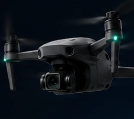
 Standard drone
Cinematic aerial filming
Smooth, stabilised aerial footage for property, business, events and promotional content.
High-resolution capture
Drone services across the West Midlands
Choose stable, polished aerial footage from a standard camera drone, fast immersive movement from an FPV drone, or detailed mapping imagery for sites and projects.
Standard drone
Smooth, stabilised aerial footage for property, business, events and promotional content.
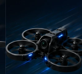 FPV drone
Dynamic, close and immersive movement for energetic sequences and one-take concepts.
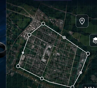 Aerial mapping
Top-down site imagery, progress records and mapping outputs for clearer project decisions.
Three distinct capabilities
Standard and FPV drones create very different footage. Mapping uses a separate, methodical capture process. Each service is planned around the site, purpose and final deliverables.
Best for wide establishing shots, smooth reveals, elevated property views and controlled cinematic movement.
Best for flying through, around or close to a subject to create speed, energy and a strong sense of movement.
Best for consistent top-down capture that provides a clear visual record of a site, boundary or project area.
Not sure which option fits? Describe the location and intended result. The recommended aircraft, flight style and deliverables can be confirmed before quotation.
Practical applications
The website does not rely on a portfolio to explain the service. Instead, each quotation defines what will be captured, where it can be flown and what files will be supplied.
Exterior aerials, location context, approach shots, development overviews and polished marketing footage.
Repeatable viewpoints, visual progress records, site overviews and mapping capture for project communication.
Exterior reveals, indoor FPV fly-throughs, facilities footage and content for websites or social media.
Dynamic FPV concepts and controlled aerial sequences planned around a suitable location and safety requirements.
Venue establishing footage, atmosphere, location highlights and aerial content subject to crowd and site restrictions.
High-level visual overviews that can help owners and contractors understand access, layout and visible conditions.
Drone mapping explained
Mapping flights use planned, overlapping images to build a consistent top-down view of the project area. The exact output depends on the site, required accuracy, access, software workflow and intended use.
Drone mapping outputs are not automatically a substitute for a formal land, structural or chartered survey. Required accuracy and professional validation must be agreed before the project.
A clear process
A practical workflow keeps the quote accurate and avoids promising a flight before the location and airspace have been reviewed.
Send the location, preferred date, service required and how the final footage or mapping will be used.
The site, nearby airspace, access, people, property and likely permissions are considered before confirming feasibility.
You receive a defined scope covering capture time, deliverables, travel, editing and any known constraints.
The flight proceeds when conditions are suitable, followed by preparation and digital delivery of the agreed files.
Operating area
Based around the West Midlands, with project-specific travel quotations for surrounding counties and other UK locations. Travel availability depends on the scope, timing and flight requirements.
Ask about your locationFlight planning
Drone work is location-dependent. A requested shot may need to change because of airspace, uninvolved people, nearby properties, access, landowner permission, weather or the type of aircraft being used.
Flights are planned against current UK drone rules, site conditions and applicable restrictions. A flight is never guaranteed until the location has been reviewed.
High wind, rain, poor visibility or unsafe surface conditions may require a revised time or date.
Landowner consent, venue approval or specific airspace permission can affect lead time and cost. These are discussed before confirmation.
Raw footage, edited clips, image formats, mapping files, usage and delivery timing are defined in the quotation.
Frequently asked questions
For an accurate answer about a particular site, include the postcode or a map pin with your message.
Ask about a projectA standard camera drone is designed for stable, smooth and controlled aerial shots. An FPV drone is flown from a first-person view and is better suited to faster, closer and more immersive movement. The right option depends on the subject, location and intended style.
Potentially, yes. Indoor work depends on space, obstacles, people, lighting, property permission and the type of FPV aircraft required. A walkthrough or site information may be needed before confirming the plan.
No. Airspace restrictions, airports, crowds, nearby property, sensitive sites, access and local conditions can limit or prevent a flight. The location must be reviewed before a booking is confirmed.
You should be authorised to commission filming at the property or site. Landowner or venue consent may be required. Where additional aviation permission appears necessary, this will be discussed during planning.
Safety takes priority. If wind, rain, visibility or other conditions make the planned flight unsuitable, an alternative time or date will be arranged in line with the booking terms.
Pricing depends on location, travel, flight complexity, time on site, permissions, aircraft type, editing and deliverables. Send the project details for a quotation rather than relying on a generic price that may not match the work.
Yes, where agreed. The quotation should state whether delivery includes raw clips, selected colour-corrected clips, a finished edit, still images or a combination.
The delivery estimate depends on the amount of footage, editing requirements and mapping processing. A realistic delivery window will be included in the quotation.
Common uses include site overviews, construction progress, land or roof visualisation and project records. Accuracy requirements must be discussed in advance, particularly where measurements or formal survey decisions are involved.
Yes, repeat visits can be planned for progress records. Consistent viewpoints or flight patterns can be agreed, subject to changing site and airspace conditions.
Core coverage includes Birmingham, Coventry, Wolverhampton, Solihull and the wider West Midlands, with surrounding counties and other UK locations considered by arrangement.
Include the site address or postcode, preferred date, service required, subject to be filmed, intended use, approximate time on site and the files you expect to receive. Photos, plans or example shot ideas are helpful.
Request a quotation
Choose the easiest way to get in touch. For a faster quotation, include the location or postcode, preferred date, required service and the final files you need.